


In this image, the white line on Mars’ surface (top) shows a stretch of land that was scanned by MARSIS. The graph below shows the shape of the land and the structure of the subsurface, with the layer of dry sediments (likely dust or volcanic ash) in brown and the layer of suspected ice-rich deposits in blue. The graph shows that the ice deposit is thousands of meters high and hundreds of kilometers wide. (Image credit: CReSIS/KU/Smithsonian Institution)-1200-80

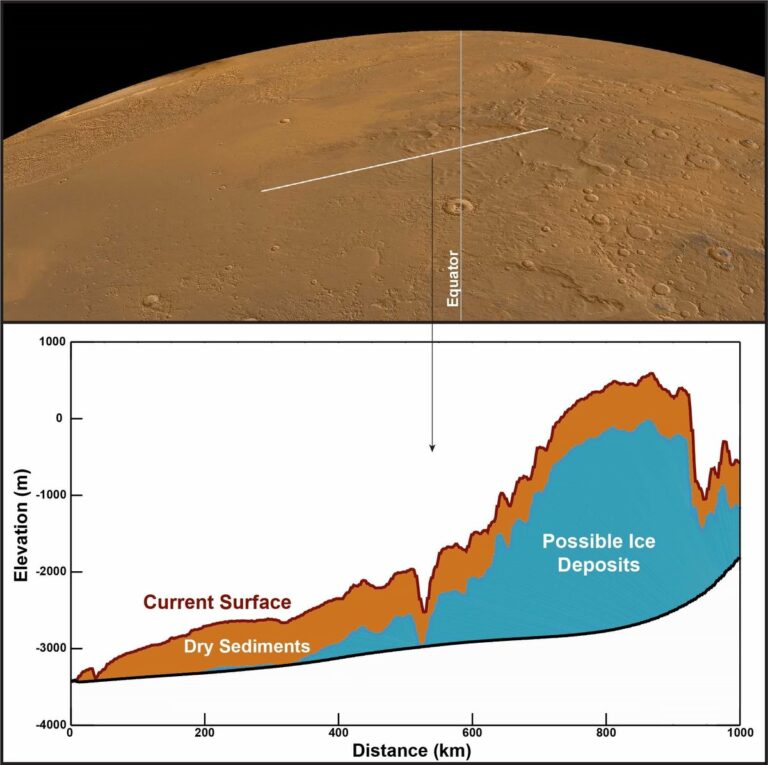
In this image, the white line on Mars’ surface (top) shows a stretch of land that was scanned by MARSIS. The graph below shows the shape of the land and the structure of the subsurface, with the layer of dry sediments (likely dust or volcanic ash) in brown and the layer of suspected ice-rich deposits in blue. The graph shows that the ice deposit is thousands of meters high and hundreds of kilometers wide. (Image credit: CReSIS/KU/Smithsonian Institution)